
Our first hike at Coopers Rock State Forest
Abby and I went on our first hike at Coopers Rock State Forest, joining a Pittsburgh hiking meetup event led by Terri and Jeff. This is a regularly held hike that we simply never got around to in previous years because of schedule conflicts or other circumstances, so we were delighted to have the opportunity to go this time.
I’d only been to Coopers Rock once, as part of a rock climbing trip, which turned out to be an embarrassing disaster for me, because after climbing only a few minutes, I decided the whole thing just made me nervous, and I sat out the rest of the day. But I was there long enough to see how beautiful the area was, and knew I wanted to go back just to hike, not to climb!
Getting there
The drive from Pittsburgh took just over an hour and a half; we took the most direct, shortest route involving taking route 51 south. (We returned instead by way of Morgantown, the long route that uses I-79, but this was a huge mistake because of traffic as we neared Pittsburgh. I don’t see any reason to take this longer route in the future, since it doesn’t actually save any time even if there had not been congestion on the highways.)
Abby and I took John and Courtney, since each of them also live in Squirrel Hill, in our car to carpool together.
Parking
It turns out, as I suspected, that parking is quite scarce in the main Coopers Rock parking lot. Now that spring is here, this is prime season for people to be visiting, of course. We arrived early enough to grab the very last spot, actually, in the main parking lot. There are other parking spaces further out, but even those were not plentiful.
Weather
There was always a chance of rain. We completely lucked out, because it didn’t start raining until after we’d completed the main hike. Then it was pouring. Pouring rain would have made the hike far less pleasant, because of the rocks and mud, but part of the experience of hiking is taking whatever nature gives us, in all humility and gratitude. We head out in the morning not knowing exactly what to expect. Sometimes the forecast the day before a planned hike looks pretty bad, in which case Abby and I might choose to cancel, but we tend not to cancel that often.
Photos
If you’re a member of the Pittsburgh meetup group, you can see photos people took.
The hike
The forecast for the day was supposed to be temperatures in the 60s and 70s F in the middle of the day. In the morning at 10 AM, however, it started out rather cool, temperature possibly in the high 30s. I was glad I packed a winter hat and gloves, just in case.
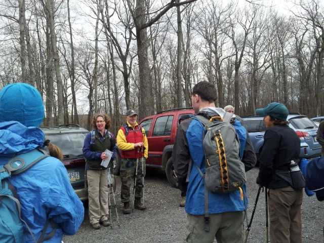
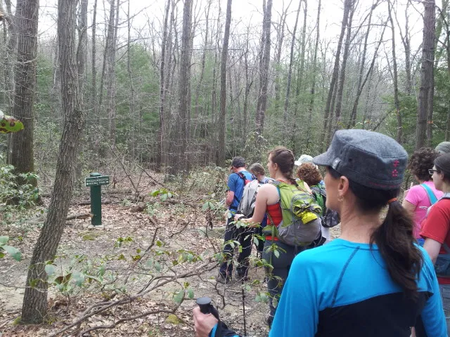
Around thirty people showed up for the group hike.
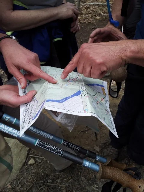
Terri had her trail map ready, accompanied by Jeff who acted as the sweep. By the way, this hike is part of an extended camping weekend that they organize, running from Friday through Sunday, so many of the hikers had already camped one night, and many planned to camp another night. Abby and I did not feel ready to do camping yet this year, so we went just for the hike.
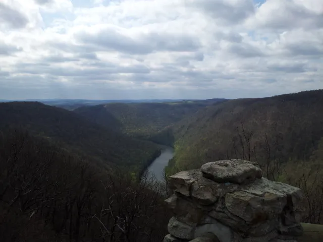
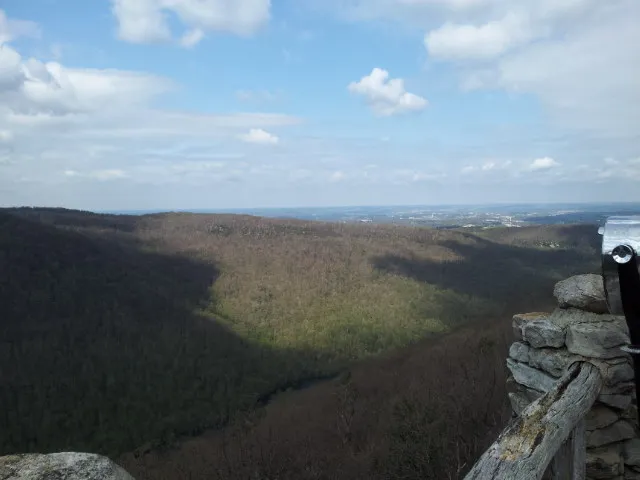
Before we started the hike proper, we checked out the main overlook. It’s beautiful. You can see Cheat River and beyond.
Heading down
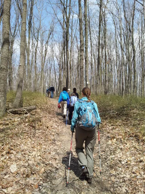
The main hike was an out (mostly down, all the way to the river) and back up, roughly 7 miles. This is not very far at all, but given the terrain and significant elevation change, as well as waiting for everyone (since it was a large group), it took a while.
A lot of rhododendron around:

There were also many little wildflowers along the trails during the hike.
We took the rocky, Rattlesnake Trail winding along cliffs. By the way, using a pair of hiking poles during the entire hike made things much easier. Both Abby and I used a pair of hiking poles as well as Vibram FiveFingers KSO Trek shoes (which prompted a lot of questions).
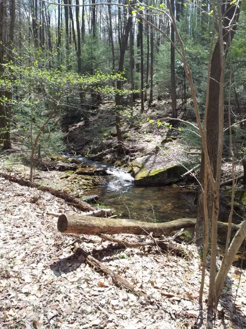
I liked how peaceful and quiet most of the hike was. Sometimes Abby and I have gone on hikes where the hum of civilization never really goes away. Here, the main hum was of water, which was usually not too far away.
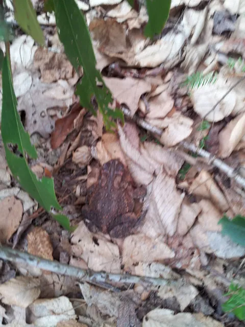
Abby spotted a huge toad!
Lunch break
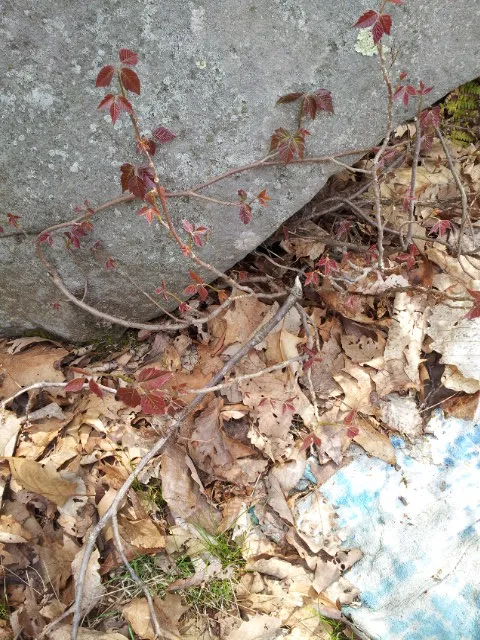
We were warned about poison ivy where we stopped for lunch by the river:

Back up
I always find it strangely appealing to hike along running water. Water makes me feel like I am not alone or lost, that there is something soothing and dependable out there:
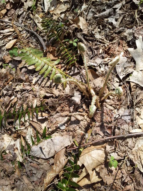
It was fun to see ferns unfurling here and there:
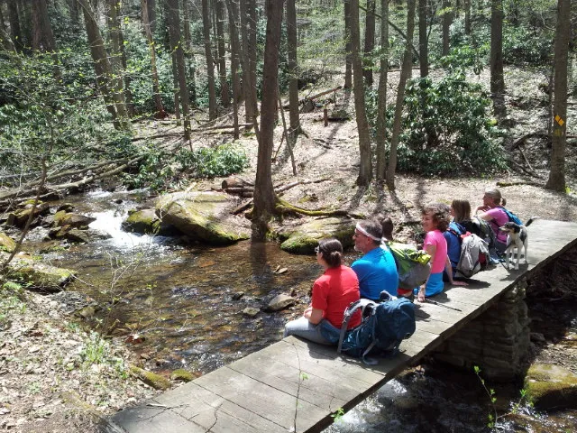
We went back a different way than we came, and that involved a bunch of stream crossings over bridges. Here, some of us sat on a bridge for a photo:
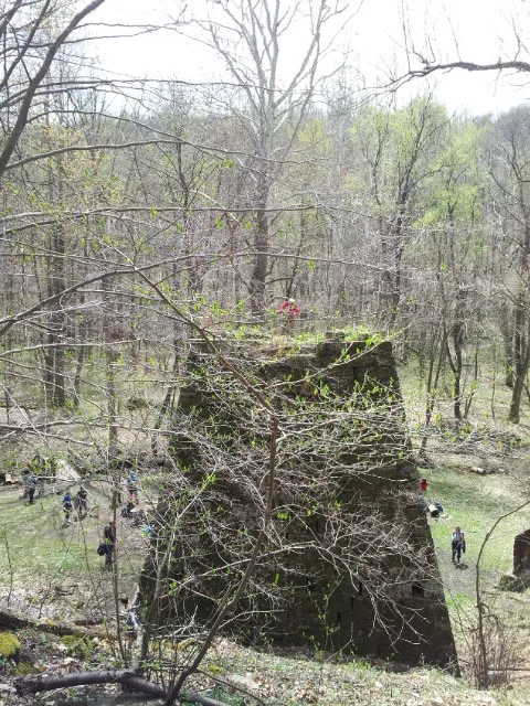
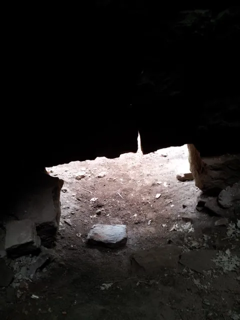
Henry Clay Iron Furnace
We took a detour to the historic Henry Clay Iron Furnace.
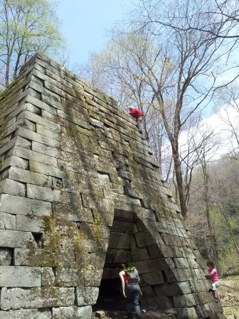
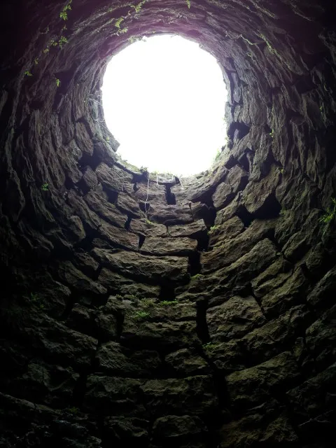
I crawled inside to take a look.
Lost?
We got “lost” on the way back to the parking lot, but not really. We missed a turn, but quickly, Terri noticed that things did not look right, and we backtracked, and turned onto the Rhododenron Trail as we should have. All good!
Back to civilization:
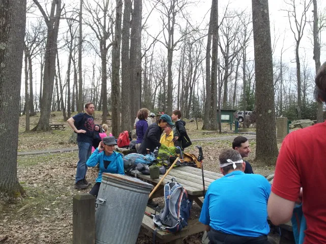
Missing the optional hike
There was an optional 3-mile hike planned after the main one, to reach another scenic area, but Terri and Jeff decided it was too complicated to officially reorganize a group for it, and just left it to everyone to figure out appropriate car pools to park in a lot nearer to it.
The four of us drove to the lot a bit later than some others, and unfortunately, someone pulled into the last parking space. As it was already drizzling rain anyway, and there was no parking to be found nearby, we just waved goodbye and started heading home. Maybe this was a good thing, because the rain quickly began to pour really hard!!
Conclusion
Coopers Rock State Forest is a great place to visit. The hiking is great, with varied terrain and elevation changes, lots to see. Perhaps in the future Abby and I will check out the camping.
Have you been to Coopers Rock? For hiking, cross-country skiing, camping, or rock climbing?